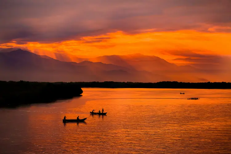
Morning reaches the water first, and only then the people, in an order that the geography of this place seems to have established long before people gave it a name. Light settles slowly over the expanse of the lagoon, over narrow channels and mangrove roots, while mist still drifts above the water and the first canoes pull away from the houses raised on stilts. Fishermen set out for the places they have known all their lives, following changes in the colour of the water, the direction of the wind and the movements of birds, in a landscape where orientation has been passed down from one generation to the next through observation, gesture and experience.
Ciénaga Grande de Santa Marta is a world in which water has become part of the very structure of life. It passes beneath houses, opens routes between communities, carries people to school and fishermen to their fishing grounds, brings food and connects the villages to the world on land, while its level and salinity change with the rains, the seasons and the waters descending from the Sierra Nevada de Santa Marta and the Magdalena River. To someone arriving from the land, this territory of lagoons, channels, islands and mangroves may appear fragmented and difficult to decipher; to the people who live here, every channel has a name, every change in the water has a cause, and every route can be read through the wind, the depth and the season.
Here, geography has become a form of knowledge, and knowledge has become a condition of life.
To understand Ciénaga Grande, we must enter this world by water.
A stilt house begins with wooden posts driven deep into the muddy floor of the lagoon, supporting the platform on which the dwelling stands, with its walls, roof and the spaces required for everyday life rising above it. The architecture locally known as palafítica is a solution born of a territory where land and water are in constant contact, and where living means accepting this movement as part of existence. Narrow walkways connect the homes, wooden platforms become places for drying fish and mending nets, while around the houses small patches of dry ground gradually take shape from shells, branches, mud and other materials brought by the water. The entire village thus stretches above the lagoon, an architecture shaped by water and by the needs of those who inhabit it.
Seen from a distance, the stilt houses may appear detached from the land and set within a wholly aquatic world; up close, however, they reveal the precision with which they have been built. The posts descend into the floor of the lagoon and anchor the dwelling in the mud, like the roots that hold the mangrove in place, providing stability in an environment constantly shaped by water, wind and changing levels. This building method speaks of a way of living in which people maintain direct contact with the water: the floor of the house stands above it, the canoe waits beneath the platform, and entering and leaving the home often means stepping directly onto the channel.
In Ciénaga Grande, the house thus becomes an extension of the water, while the village takes the form of a community settled between two worlds: the land evoked by its materials and the water that organizes its entire existence.
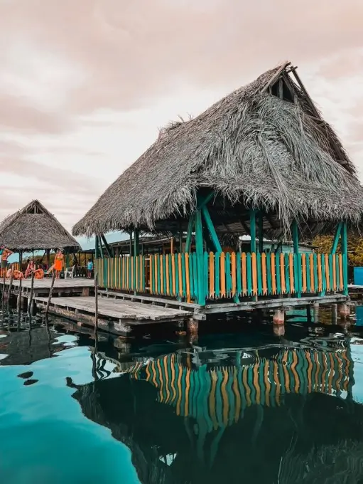
A stilt house begins with a structure of wooden posts driven into the muddy floor of the lagoon and set deep enough to support the platform on which the dwelling stands. Above the water come the floor, walls and roof, while around the house an entire world gradually takes shape: spaces for nets and tools, places for cleaning and drying fish, platforms for canoes, and small patches of dry ground built up over time from shells, branches and sediment. Walkways connect the homes, while water remains permanently present in the life of the house — beneath the floor, at the entrance, around the platform, along the route of every canoe.
Where the land is absent, it can be created slowly, from the traces left by water. Around some homes, these small patches of dry ground have formed over time from materials brought in, deposited and consolidated by people, transforming the immediate space around the house into a fragile extension of the land. The dwelling rises above the water and develops alongside the territory that sustains it.
The construction and maintenance of such a house often involve family, neighbors and friends, while technical knowledge is passed on through the gestures with which a community builds and repairs its homes. Where a post should be driven, how the platform should be positioned, which materials will endure, how the house should be connected to the walkway — all belong to a practical knowledge shaped by experience and passed down through generations. In this way, stilt architecture becomes more than a solution for habitation. Its structure preserves an understanding of the water, its changing levels, the winds and the materials offered by the territory. The house thus becomes one of the forms through which the community passes on its knowledge of the place it inhabits.
Ciénaga Grande forms part of a vast lagoon-estuarine system where the fresh waters of the Magdalena River and the rivers descending from the Sierra Nevada de Santa Marta meet the salt waters of the Caribbean Sea. To the north, Isla de Salamanca separates the lagoon complex from the sea, while through Boca de la Barra, seawater enters the system; from the south and east come the waters of the Fundación, Aracataca and Sevilla rivers, descending from the Sierra Nevada, while Caño Clarín provides the connection with the Magdalena.
Water, mangrove, fish, houses and the routes between villages form the same reality.
The entire system functions through a permanent circulation between fresh and salt water, between periods of rain and drier seasons, between the waters and sediments carried by the rivers and the influence of the sea. This continual meeting shapes not only the landscape but also the conditions in which life can develop here.
The landscape as it exists today is the result of geological processes unfolding over millennia, as sediments and coastal dynamics contributed to the formation of the coastal barrier and the gradual transformation of an ancient marine gulf. What remains today is a complex of lagoons, channels, wetlands and mangrove forests, a territory in which the character of the water is constantly changing, while life depends precisely on this alternation between fresh and salt water.
During the rainy season, the influx of fresh water increases and the continental influence extends; during drier periods, the marine influence may become more pronounced and salinity rises in certain parts of the complex. Between these two influences lies a remarkably rich biological world, and the people who live here have learned to organise their lives around its changes. Fishing, movement between villages, the condition of the mangroves and even access to certain areas depend on this dynamic, in which water levels, salinity and circulation between different bodies of water change from one season to the next.
The Magdalena plays an essential role in this story. The river brings fresh water, sediment and organic matter from Colombia's interior and carries them towards the coast, while its connection with Ciénaga Grande was profoundly altered during the twentieth century by roads, canals and other interventions that changed the natural circulation of water. The construction of the Ciénaga–Barranquilla road, around the 1950s and 1960s, altered the connection between the Magdalena and the system of mangroves and wetlands, contributing to hydrological changes and increased salinity; subsequent interventions intensified the imbalance in certain sectors.
When these hydrological connections are interrupted or weakened, the effects spread throughout the ecosystem: water circulation changes, salinity may rise, and the mangroves become vulnerable.
For an ecosystem, such a change may seem abstract on a map. For a fisherman, it translates into a smaller catch, a more difficult journey and a day when the water offers less than it once did.
In Ciénaga Grande, ecology and everyday existence meet in the same element: water.
Human presence in this region long predates the emergence of the stilt villages we associate today with Ciénaga Grande.
At Los Jagüeyes, near Isla de Salamanca, archaeologists have identified shell middens — concheros — dating to around AD 362. Other sites, including Mina de Oro, Palmira, Tasajera and Loma de López, document human presence across several centuries, from Late Antiquity into the first millennium of our era. The remains reveal communities that exploited the region's aquatic and terrestrial resources, particularly molluscs and other marine and lagoon resources, alongside agricultural activities during certain periods.
These shell accumulations are more than simple traces of meals consumed in the past. They are archaeological archives of the way pre-Hispanic communities inhabited this territory, and recent research is using them to reconstruct the diet, fishing practices, environment and organization of these populations.
The remains discovered in the region also indicate connections between the communities of Ciénaga Grande and populations in the lower Magdalena valley and the foothills of the Sierra Nevada de Santa Marta. The exchange of resources and movement of people created links between different geographical environments, while water may have been one of the routes through which these relationships unfolded. Later historical sources describe exchanges between the populations of the Ciénaga and those of the Sierra, including the trade in fish and salt.
The stilt villages we see today emerged in a much more recent period. Nueva Venecia, initially known as El Morro, dates its origins to 1847, when fishermen from the settlement of Trojas de Gálvez, near Sitionuevo and the Magdalena River, moved to the lagoon area of Ciénaga de Pajaral. The choice of the new location was connected to its environmental conditions and the resources provided by fishing, and the settlement would become one of the most representative stilt communities in the complex.
Alongside Buenavista and Bocas de Aracataca, it is one of the three lakeside communities that have preserved to this day a form of habitation built around water. For these villages, artisanal fishing became the principal economic activity, while the canoe remained the natural means of travel between houses, fishing grounds and markets on land. UNESCO describes these settlements as examples of adaptation to the lagoon environment, in which dwelling, working space and the movement of water together form a cultural structure transmitted across generations.
El Morro would later take the name Nueva Venecia. According to the local history recorded by researchers, the change of name is associated with Ismael Ambrosio Moreno, who showed residents images of Venice and its navigable canals. The resemblance to their own watery world became strong enough for the old El Morro to become known thereafter as Nueva Venecia.
The name may suggest a European comparison, yet the reality of the two places is entirely different. Here, the canals were not designed for a city; they have always been part of the territory, while houses and routes were built around them.
The fishermen's morning begins before the light has reached the entire lagoon. The canoes pull away from the jetties, and the atarraya, the circular hand-cast net, becomes the instrument through which the fisherman seeks his food in the water he has known since childhood.
The fisherman knows where the fish gather, the differences in depth, changes in salinity and the signs of the weather. He learns to read the water through its colour and surface, the wind through its direction and strength, while the approach of certain species can sometimes be sensed through the behaviour of birds. What may appear, from the outside, to be instinct is in fact a body of knowledge built through years of experience and passed down through generations.
More than fifty species of fish have been identified in the waters of Ciénaga Grande, including bocachico, bagre tigre, nicuro, moncholo, lisa, róbalo, sábalo and mojarra rayada. Some form part of the local economy and reach Barranquilla and other urban centres through the markets of settlements on land. Fishing thus connects the stilt communities to a much wider geography: what is caught in the lagoon continues beyond its boundaries, becoming food, income and exchange.
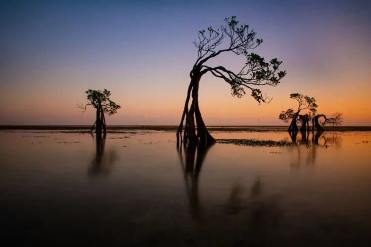
The mangroves sustain this circuit. Rhizophora mangle, the red mangrove, extends its aerial roots through water and sediment, providing shelter for young fish and stabilising the banks; Avicennia germinans can survive in areas of high salinity, while other species complete this forest of the frontier between land and water.
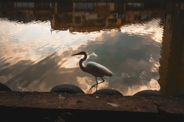
A significant part of the region's biodiversity is concentrated around them. Cormorants, anhingas, herons, egrets, jacanas, chavarriá and jabiru use the waters and wetlands for feeding and resting, while Ciénaga Grande is also an important stopover for migratory birds arriving from North America. At certain times, blue-winged teal can be observed in large groups, while the presence of the Caribbean flamingo adds another dimension to this geography of water.
In the less accessible areas live Neotropical otters, howler and capuchin monkeys, raccoons, capybaras, caimans and American crocodiles, while in certain sectors the Caribbean manatee may also appear. Each of these presences depends, in one way or another, on the quality of the water and the health of the habitats that surround it.
Mangrove and water form a biological network in which every change propagates onwards, and people are part of the same network on which they depend.
Recognition of the value of this ecosystem came gradually. In 1977, Ciénaga Grande de Santa Marta was declared a Santuario de Flora y Fauna, while in 1998 the Magdalena River Delta Estuarine System and Ciénaga Grande de Santa Marta were designated a Ramsar site, covering 400,000 hectares. In 2000, the region was designated a UNESCO Biosphere Reserve, a recognition that highlighted both the ecological importance of the complex and the relationship between its human communities and ecosystems.
These designations established the ecological importance of the area at national and international level, yet the problems accumulated over decades continued to exist. In 2017, Ciénaga Grande was included in the Montreux Record of the Ramsar Convention, intended for sites where changes in ecological character have occurred or may occur. The decision followed a Ramsar advisory mission and an assessment of the state of the ecosystem.
Reduced freshwater inflow, changes in hydrological circulation, increased salinity in certain areas, channel sedimentation and the loss of mangroves have affected the ecosystem, and the consequences have reached directly into communities dependent on fishing. Infrastructure changes beginning in the 1950s altered the relationship between the Magdalena River and the complex of mangroves and wetlands, while subsequent hypersalinity contributed to the loss of significant areas of mangrove.
When fish become scarcer, the problem does not remain in the water. It reaches family tables, fishermen's incomes and the ability to maintain a house built above the lagoon.
In recent decades, restoration projects have sought to restore the hydrological connections between the Magdalena and the lagoon complex and to recover affected mangrove areas. INVEMAR, the Ministry of Environment, Parques Nacionales and other institutions have taken part in programs of monitoring, research and restoration, alongside initiatives involving local communities.
For Ciénaga Grande, conserving the ecosystem inevitably means conserving a culture as well. Healthy mangroves provide habitat for fish; fish provide food and income; properly circulated water provides navigation and ecological balance; and all of this ultimately returns to the life of the villages.
Here, environmental restoration means recovering an ecosystem on which the continuity of a community depends, together with the place it has made its home.
For this reason, the future of the stilt communities cannot be separated from the future of the lagoon.
Ciénaga Grande has sometimes been compared with Venice or presented as a hidden tropical paradise, yet such formulas say too little about what lies here. The stilt settlements are not settings constructed for the visitor's gaze, and the lagoon is not a destination waiting to be “discovered”. It is an inhabited territory, with an ancient history, with work, vulnerability, beliefs, conflicts and forms of solidarity built around water.
The recent history of the stilt communities also bears the traces of the armed conflict in the region. In 2000, Bocas de Aracataca, Nueva Venecia and Buenavista were affected by massacres and paramilitary violence, and residents were forced to leave their homes, at least in part. In the years that followed, many residents of Nueva Venecia and Buenavista returned to their communities, while Bocas de Aracataca remained largely depopulated.
This part of the history matters precisely because it prevents the villages from being turned into an idyllic image detached from the reality of the people who live there. Life above the water has meant adaptation, work and loss, while the continuity of these communities has been tested by forces that came from beyond their geography.
Today, access to different areas of the complex depends on their protection status and conservation rules. The Ciénaga Grande de Santa Marta Santuario de Flora y Fauna has a strict conservation regime, while the stilt communities lie within its area of influence and maintain their own forms of life, fishing and relationship with the water.
In such a geography, protecting the place begins with understanding the relationship between the ecosystem and the communities that live around it. Water, mangrove, fish, houses and the routes between villages form the same reality, and every intervention affecting one of these elements reverberates through the others.
Ciénaga Grande can be viewed, then, from a boat, from the shore or from a distance. To understand it, however, it must be seen through the people who have learned to read the water and build their lives around it.
Towards evening, when the canoes return laden with the day's catch or almost empty, depending on what the lagoon has offered, the light changes over the houses and the water. The wooden posts are reflected on the surface of the lagoon, the mangroves gradually lose their outline, and the birds seek their resting places. Upstream, the Magdalena continues to flow northwards, carrying water and sediment from Colombia's interior, while the rivers of the Sierra Nevada descend towards the same lagoon world.
Here, time has another measure. Houses are repaired, canoe after canoe sets out and returns, generations succeed one another, and the water continues to reshape the territory without interrupting its continuity.
Generation after generation, the people here have learned to read the water before they could control it, to accept its changes and arrange their lives around them. They have built houses where land was absent, turned channels into roads and made fishing a form of knowledge passed on through gestures. Over time, these practices have given rise to a way of life in which habitation, work and territory have become inseparable.
Ciénaga Grande is, in this sense, more than a community adapted to an aquatic environment. It is a territory in which people have built their continuity around water, and water has become part of the history they pass on.
Here, where land and water meet, people have found their place, roots, and learned to live on water.
Sources
Protected area Santuario de Flora y Fauna Ciénaga Grande de Santa Marta – Parques Nacionales Naturales de Colombia (1977) . Via Parques Nacionales Naturales de Colombia 🔗
Ramsar site Sistema Delta Estuarino del Río Magdalena, Ciénaga Grande de Santa Marta – Ramsar Sites Information Service (1998) . Via Ramsar Sites Information Service 🔗
Biosphere reserve Ciénaga Grande de Santa Marta Biosphere Reserve – UNESCO (2000) . Via UNESCO 🔗
Tentative World Heritage List Cultural Landscape of the Vernacular Stilt Housing of Cienaga Grande de Santa Marta and of Medio Atrato – Permanent Delegation of Colombia to UNESCO (2013) . Via UNESCO World Heritage Centre 🔗
Historical memory Ese día la violencia llegó en canoa – Centro Nacional de Memoria Histórica (n.d.) . Via Centro Nacional de Memoria Histórica 🔗
Academic publication Nueva Venecia – Universidad del Magdalena (n.d.) . Via Universidad del Magdalena 🔗
Technical report Informe Técnico Ciénaga Grande de Santa Marta, 2024 – INVEMAR (2024) . Via INVEMAR 🔗
Government portal Ciénaga Grande de Santa Marta – Ministerio de Ambiente y Desarrollo Sostenible (n.d.) . Via Ministerio de Ambiente y Desarrollo Sostenible 🔗